Why is this Flood Study being done?
To improve the understanding of flooding within the City of Botany Bay, Council is preparing a detailed Flood Study for each of the catchment areas within the city. The study will build on previous flood investigations to develop a formalised flood study of the whole catchment area. This study will assist the council to plan for, and manage, existing and any future flooding risks.
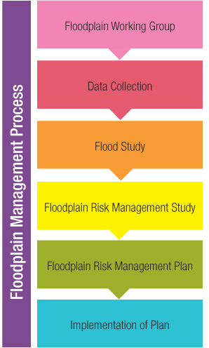
Under the NSW Government Flood Prone Land Policy, management of flood prone land is primarily the responsibility of councils. The flow chart to the right shows the Floodplain Management Process that Councils follow in order to identify, understand and manage flood risk.
- The Flood Study defines the nature and extent of the flood problem.
- The Floodplain Risk Management Study assesses management options with respect to existing and proposed development.
- The Floodplain Risk management Plan provides Council with a management plan for the floodplain, and is often undertaken in conjunction with the Floodplain Risk Management Study.
- Implementation of the Plan involves enacting the recommendations of the Floodplain Risk Management Plan to mitigate flood risks to life and property.
The project is undertaken in partnership with the NSW Office of Environment and Heritage.